Social indicators
| Population growth rate (average annual %) | 0.6 (2023, World Bank) |
| Urban population growth (annual %) | 2.1 (2023, World Bank) |
| Rural population growth rate (average annual %) | -0.6 (2023, World Bank) |
| Urban population (%) | 44 (2023, World Bank) |
| Population aged 0-14 years (%) | 22 (2023, World Bank) |
| Education: Primary-secondary gross enrolment ratio (f/m per 100) | 1.06 (2018, World Bank) |
| Sex ratio at birth (male births per female births) | 1 (2022, World Bank) |
| Life expectancy at birth (females and males, years) | 72 (2022, World Bank) |
| Infant mortality rate (per 1,000 live births) | 20 (2022, World Bank) |
| Fertility rate, total (births per woman) | 1.4 (2022, World Bank) |
Economic Indicators
| GDP per capita (US$) | 3,704.0 (2022, World Bank) |
| GDP growth rate | 5.2 (2023, World Bank) |
| Adjusted net national income (current US$) (Millions) | 2,283.96 (2021, World Bank) |
| GNI per capita, Atlas method (current US$) | 3,590 (2022, World Bank) |
The National Environment Commission is a high-level autonomous agency of the Royal Government of Bhutan and is mandated to look after all issues related to environment in Bhutan.- www.nec.gov.bt
Bhutan is an active member of SACEP since its inception in 1982.
Country’s Environmental Profile
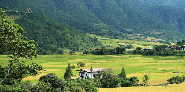
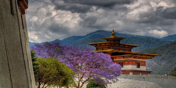
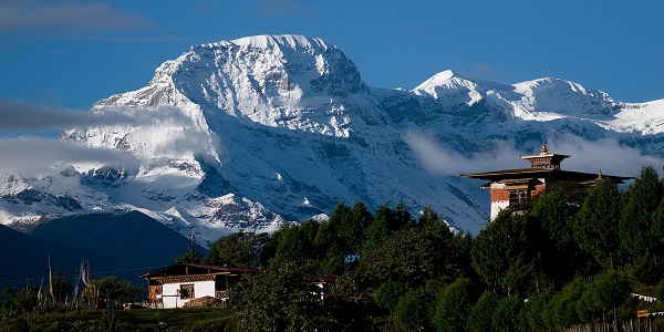
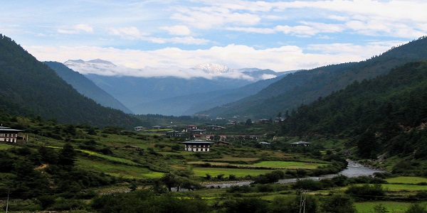
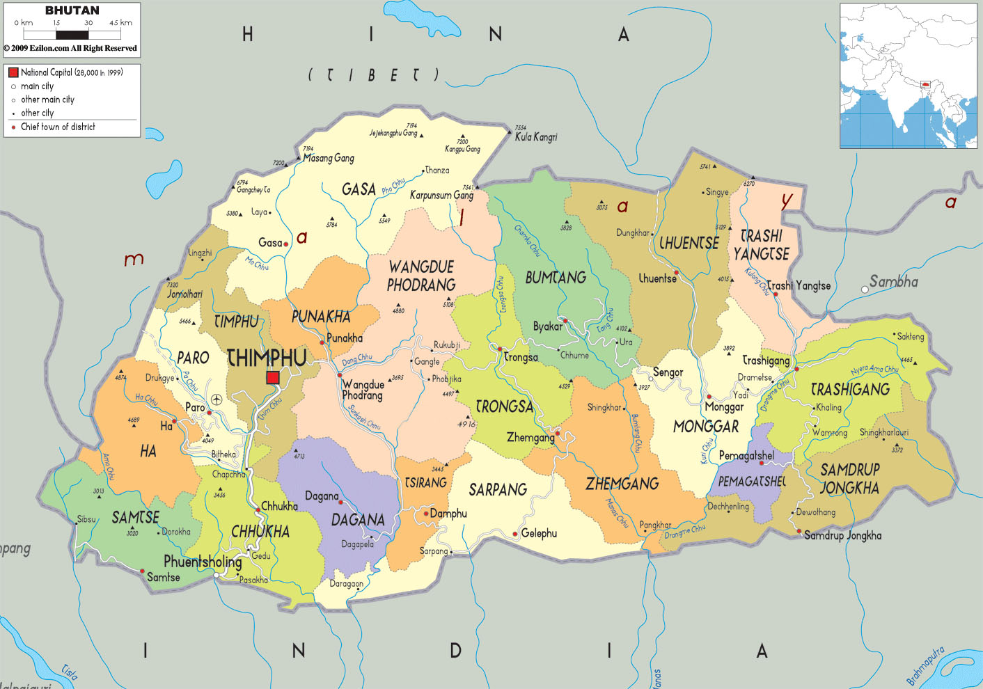
The Kingdom of Bhutan is a small, land-locked mountainous nation in South Asia, located in the eastern Himalaya Mountains north of India and south of China with more than half the urban population concentrated in just two towns – Thimphu and Phuentsholing. Thimphu alone has more than 40% of the total urban population while Phuentsholing has more than 10%.
Bhutan is a predominantly agrarian society with 69% of the population living in rural areas and subsisting on an integrated livelihood system of crop agriculture, livestock rearing and use of a wide range of forest products. High precipitation, extensive forest cover and well-preserved watersheds have endowed the country with abundant hydropower resources. The country’s economy is basically driven by renewable natural resources sector, hydropower production, tourism, and industrial development
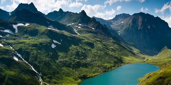
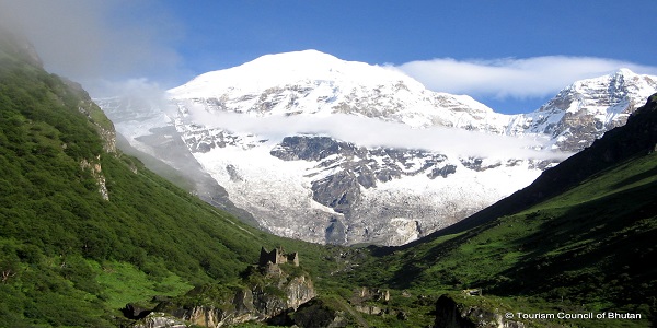
Forest is by far the most dominant land cover, with 72.5% of the country under forest cover – one of the highest in the world. The country’s terrain is mostly mountainous with extreme variation in elevation (97 m to 7,553 m) with few fertile valleys and savannah. The fauna of Bhutan is also very diverse with more than 160 mammal species reported. Grey langurs, macaques, tigers, leopards, goral, serow, black bear, fox, deer, and many other species live in the temperate zone. The high altitude fauna is mostly paleoarctic in origin and includes takin, blue sheep, red panda, snow leopard, brown bear, wolf, steppe cat, and Tibetan antelope Storms and frequent landslides during the rainy season are the two main natural hazards faced by Bhutan, hence the name meaning “the Land of the Thunder Dragon”.
Principal Environmental Laws
Environmental Related Reports
Major Environmental Issues:
Important Web sites