Social indicators
| Population growth rate (average annual %) | 0.8 (2023, World Bank) |
| Urban population growth (annual %) | 2.2 (2023, World Bank) |
| Rural population growth rate (average annual %) | 0 (2023, World Bank) |
| Urban population (%) | 36 (2023, World Bank) |
| Population aged 0-14 years (%) | 25 (2023, World Bank) |
| Education: Primary-secondary gross enrolment ratio (f/m per 100) | 0.99 (2021, World Bank) |
| Sex ratio at birth (male births per female births) | 1 (2022, World Bank) |
| Life expectancy at birth (females and males, years) | 68 (2022, World Bank) |
| Infant mortality rate (per 1,000 live births) | 26 (2022, World Bank) |
| Fertility rate, total (births per woman) | 2 (2022, World Bank) |
Economic Indicators
| GDP per capita (US$) | 2,484.8 (2023, World Bank) |
| GDP growth rate | 7.6 (2023, World Bank) |
| Adjusted net national income (current US$) (Millions) | 2,697,069.32 (2021, World Bank) |
| GNI per capita, Atlas method (current US$) | 2,540 (2023, World Bank) |
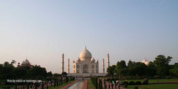
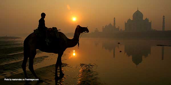
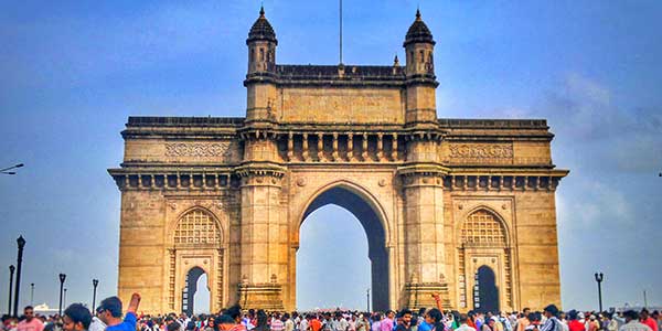
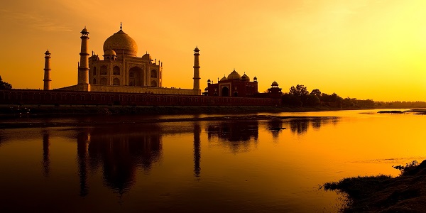
India is a vast South Asian country with diverse terrain – from Himalayan peaks to Indian Ocean coastline – and history reaching back 5 millennia. In the north, Mughal Empire landmarks include Delhi’s Red Fort complex, massive Jama Masjid mosque and Agra’s iconic Taj Mahal mausoleum. Pilgrims bathe in the Ganges in Varanasi, and Rishikesh is a yoga center and base for Himalayan trekking.
Country’s Environmental Profile
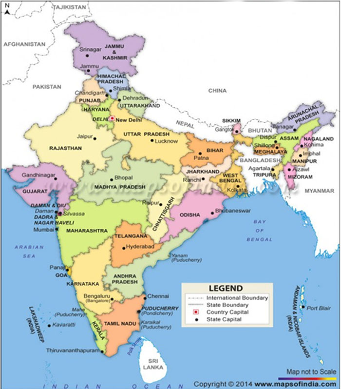
India is the seventh largest country in the world . Bounded by the Great Himalaya in the North, it stretches southwards and at the Tropic of Cancer, tapers off into the Indian Ocean between the Bay of Bengal in the East and the Arabian Sea in the West. The country accounts for 2.42 per cent of the world’s total land area and sustains 16 per cent of the world population.
The climate of India is dominated by the Asiatic monsoon, most importantly by rains from the south-west between June and October, and drier winds from the north between December and February. From March to May the climate is dry and hot.
The northern most point of the Indian mainland lies in the state of Jammu and Kashmir and the southernmost point is Kanyakumari in TamilnaduFrom its northernmost point to the southern tip, India stretches 3,200 kilometres (2,000 miles) and has 26 states.
The mainland comprises of four regions,
THE GREAT NORTHERN MOUNTAINS
They include the mountains and plateaus of northern Kashmir, the Himalayas proper and the hills of Arunachal Pradesh, Nagaland, Manipur, Mizoram, Tripura and Meghalaya.
THE GREAT NORTHERN PLAINS
This plain extends from west to east, between Himalayas in the north and Great Indian Plateau in the south. The plain extends from the arid and semi-arid areas of Rajasthan in the west to Brahmputra valley in the east. This plain is very fertile and a very sizeable part of the Indian population lives in innumerable villages and several big cities in this region.
THE GREAT INDIAN PLATEAU
The Great Indian Plateau lies to the South of the Great Northern Plains. This is the largest physiographic division of our country. It covers an area of about 16 lakh square km, i.e., about half of the total area of the country. It is an old rocky plateau region. The topography consists of a series of plateaus and hill ranges interspersed with river valleys.
COASTAL PLAINS
The Great Plateau of India is surrounded by plains on all sides. In the north lies the Great Northern Plain and in south, along the east and west lie the Coastal Plains.
East Coastal Plain extends along the coast of the Bay of Bengal from Ganga Delta in the north to Kanyakumari in the south.
West Coastal Plain extends along the Arabian Sea from the Rann of Kutchch in the north to Kanyakumari in the south. Except for the Gujarat plain, the western coastal plains are narrower than the eastern coastal plain The total length of the coastline, including the mainland, Lakshadweep Islands, and the Andaman and Nicobar Islands is 7, 517 km.
16.8 INDIAN ISLANDS
There are two small groups of islands. One of these situated in the Bay of Bengal, off the coast of Myanmar is known as the Andaman and Nicobar Islands. The other is known as Lakshadweep and situated in Arabian Sea, off the coast of Kerala.
Bio Diversity
India has about 91,000 species of animals and 45,500 species of plants, that have been documented in its ten bio-geographic regions. Of these 12.6% of mammals, 4.5% of birds, 45.8% of reptiles, 55.8% of amphibians and 33% of Indian plants are endemic, being found nowhere else in the world. The country also contained many threatened species. These include 53 species of mammal, 69 birds, 23 reptiles and 3 amphibians. The country has three of 34 “global biodiversity hotspots” – unique, biologically rich areas which are facing severe conservation threats
Wetlands
India has a rich variety of wetland habitats. The total area of wetlands (excluding rivers) in India is 58,286,000ha, or 18.4% of the country, 70% of which comprises areas under paddy cultivation. A total of 1,193 wetlands, covering an area of about 3,904,543 ha,
Two sites – Chilka Lake (Orissa) and Keoladeo National Park (Bharatpur) – have been designated under the Convention of Wetlands of International Importance (Ramsar Convention) as being especially significant waterfowl habitats
Marine Environment
India’s coast is 7,517 km (4,671 miles) long; of this distance, 5,423 km (3,370 miles) belongs to peninsular India, and 2,094 km (1,301 miles) to the Andaman, Nicobar, and Lakshadweep Islands. The
mainland coast consists of the following: 43 per cent sandy beaches, 11 per cent rocky coast including cliffs, and 46 per cent mud flats or marshy coast. Notable coastal features of India comprise the marshy Rann of Kutch in the West and the alluvial Sundarbans Delta in the East, which India shares with
Bangladesh. India has two archipelagos – the Lakshadweep, coral atolls beyond India’s South-Western coast, and the Andaman and Nicobar Islands, a volcanic island chain in the Andaman Sea.
The nearshore coastal waters of India are extremely rich fishing grounds. There are five species of marine turtle occur in Indian waters: Green turtle Chelonia mydas, Loggerhead Caretta caretta, Olive Ridley Lepidochelys olivacea, Hawksbill Eretmochelys imbricata and Leatherback Dermochelys coriacea.
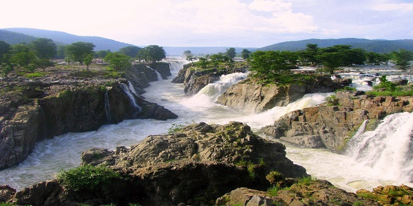
The rivers
The rivers of India can be classified into four groups , the Himalayan rivers, the Deccan rivers, the coastal rivers, and rivers of the inland drainage basin.
Environment Indicators
| Threatened species | – 988 (2014) |
| Forested area (% of land area) | – 23.1 (2012) |
| Proportion of terrestrial and marine areas protected (%) | – 3.1 (2014) |
| Population using improved drinking water sources (%) | – 93.0 (2012) |
| Population using improved sanitation facilities (%) | – 36.0 (2012) |
| CO2 emission estimates (000 metric tons and metric tons per capita) | – 2074345/1.7 (2011) |
| Energy supply per capita (Gigajoules) | – 28.0 (2012) |
Principal Environmental Laws
MEAS signed
India is member of almost all major Multilateral Environmental Agreements (MEAs),under four clusters,
Environmental Related Reports
State of Environment (SoE) Report – India
Major Environmental Issues:
Important Web sites