Social indicators
| Population growth rate (average annual %) | -0.7 (2023, World Bank) |
| Urban population growth (annual %) | 0.3 (2023, World Bank) |
| Rural population growth rate (average annual %) | -0.9 (2023, World Bank) |
| Urban population (%) | 19 (2023, World Bank) |
| Population aged 0-14 years (%) | 22 (2023, World Bank) |
| Education: Primary-secondary gross enrolment ratio (f/m per 100) | 1.02 (2018, World Bank) |
| Sex ratio at birth (male births per female births) | 1 (2022, World Bank) |
| Life expectancy at birth (females and males, years) | 77 (2022, World Bank) |
| Infant mortality rate (per 1,000 live births) | 6 (2022, World Bank) |
| Fertility rate, total (births per woman) | 2 (2022, World Bank) |
Economic Indicators
| GDP per capita (US$) | 3,828.0 (2023, World Bank) |
| GDP growth rate | -2.3 (2023, World Bank) |
| Adjusted net national income (current US$) (Millions) | 80,018.42 (2021, World Bank) |
| GNI per capita, Atlas method (current US$) | 3,540 (2023, World Bank) |
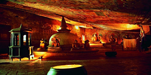
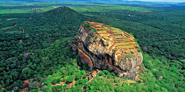
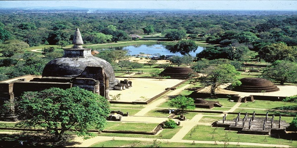
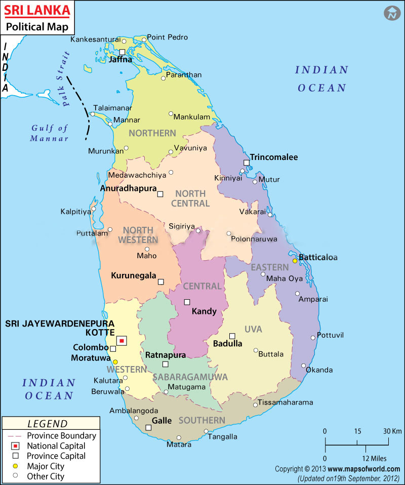
Sri Lanka (formerly Ceylon), a tiny island nation south of India in the Indian Ocean, is a rugged land of rainforest, diverse wildlife and endless beaches. It’s famed for its ancient Buddhist ruins, including the 5th-century citadel Sigiriya, with its palace and frescoes, and the sacred city of Anuradhapura. Its flavorful cuisine reflects its history as a maritime hub and cultural melting pot.
Country’s Environmental Profile
The Democratic Socialist Republic of Sri Lanka is an island in the Indian Ocean, which lies off the south-eastern tip of the Indian Subcontinent. The island’s strategic location in the Indian Ocean, intersecting with the major air and sea routes between Europe and the Far East, gives it an strategic advantage as a global logistics hub.
The country has a maximum length of 432 km (Devundara to Point Peduru) and maximum breadth 224 km (Colombo – Sangamankanda) . Sri Lanka with its tear-dropped shape is dominated by the astonishingly varied features of topography, making it one of the most scenic places in the world. The country has three zones which can be divided by its distinguished elevation: the central highland, the plains, and the coastal belt.
The coastal belt surrounding the island, consists of scenic sandy beaches and lagoons. Best beaches line along the southern coast, southwestern coast and eastern coast. In the northeast and the southwest, the coasts cut across the stratification of crystalline rocks, cliffs, bays, and offshore islands, creating one of the world’s best natural harbors
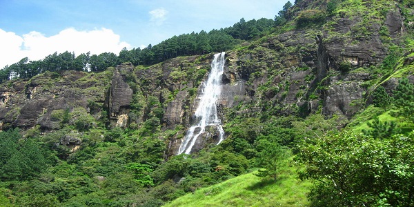
Rivers in Sri Lanka originates in the central highlands, near Adam’s Peak and flow through the gorges, broad valley and plains and finally empty in the sea near Trincomalee, creating the different landscapes of escarpments, waterfalls and deep gorges. Most of the rivers are short and frequently interrupted by the discontinuities of terrain. The longest river of Sri Lanka is the Mahaweli Ganga with its length of 335 kilometers.
The average yearly temperature in Sri Lanka as a whole ranges from 28 to 32oC. The mean temperature varies from a chilly low of 16ºC in Nuwara – Eliya in the Central Highlands, where even frosting might occur for several days in the winter, to a high of 32oC in Trincomalee on the northeast coast. The coastal areas are cooled by sea breezes.
Rainfall in Sri Lanka has multiple origins. Monsoonal, Convectional and expressional rain accounts for a major share of the annual rainfall. The mean annual rainfall varies from under 900mm in the driest parts (southeastern and northwestern) to over 5000mm in the wettest parts (western slopes of the central highlands).
Sri Lanka can be characterized in to 4 climate seasons as follows:-
The main forest types in the country are the lowland, sub-montane and montane tropical rainforests of the wet zone; moist monsoon forests of the intermediate zone; and the dry zone monsoon forests, tropical thorn forests and dry riverine forests in the dry zone.
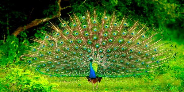
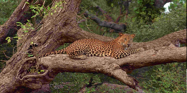
Sri Lanka’s biodiversity is considered to be the richest per unit area in the Asian region with regard to mammals, reptiles, amphibians, fish and flowering plants.The country has 677 extant species of indigenous vertebrate , and a further 262 species of migrant birds. Endemism among vertebrates is about 43%, with highest endemism among amphibians, freshwater fishes and reptiles. Similarly the island is home to over 3000 angiosperms, of which a quarter comprises endemic species.
Coral reefs are among Sri Lanka’s most valuable shallow water marine ecosystems. Three types of distinctly different reefs comprising coral, sandstone, and rocky reefs have been identified around the island, occurring separately or mixed together. Fringing coral reefs are found along 2% of the coastline. The most extensive coral reefs in Sri Lankan waters are the patchy coral reefs in the northwestern coastal and offshore waters, occurring within the Gulf of Mannar and west of the Kalpitiya Peninsula . Together these reefs support around 72 reef fishes, some of which are important in the ornamental as well as the food fishery
Further, Sri Lanka’s coastal waters have extensive sea grass beds that often occur in association with coral reef ecosystems or within estuaries and lagoons (CCD, 2004). Around 12 species of seagrasses have been recorded in Sri Lankan waters
Sri Lanka’s coastline has many picturesque and economically important estuaries and lagoons. These complex systems contain a diversity of species and a variety of coastal habitats including, mangroves, salt marshes, seagrass beds and mud flats. Overall, there are 45 estuaries, of which 28 are of the riverine type that discharge directly to the sea, and 17 are of the basin type.
Major International Environmental Agreements :
| Threatened species | 576 (2014) |
| Forested area (% of land area) | 29.2 (2012) |
| Proportion of terrestrial and marine areas protected (%) | 2.6 (2014) |
| Population using improved drinking water sources (%) | 94.0 ( 2012) |
| Population using improved sanitation facilities (%) | 92.0 ( 2012) |
| CO2 emission estimates (000 metric tons and metric tons per capita) | 15233/0.7 (2011) |
| Energy supply per capita (Gigajoules) | 18.0 (2012) |
Principal Environmental Laws
MEAS signed
Environmental Related Reports
CBD Reports
Major Environmental Issues:
Important Web sites


